Municipal Parks
Bannerman Park
Bowring Park
Rotary Park
Victoria Park
Bannerman Park
The largest parks in our network, our municipal parks are destination for people of all ages and ability to participate in both active and passive recreational activities. From tournaments to festivals, our municipal parks play host to regional and provincial events and are the home of our larger destination-based facilities.
Location:
The park is bounded by Rennie's Mill Road, Circular Road, Bannerman Road and Military Road. Google Map of Bannerman Park
The park was formed on land set aside for public use by Governor Bannerman in 1864. Bannerman Park remains a well used and attractive park, and a good example of 19th century public park design, reflecting the British parks of that time. In 2010, the Bannerman Park Foundation was formed to implement the Bannerman Park Master Plan. The City and the Foundation celebrated the completion of this effort at the Grand Re-Opening during St. John's Days, 2015.
Amenities:
Ballfield
Canteen/Beavertails
Monuments
The Loop
Open Spaces
Playground
Swimming Pool/ Splash Pad
Walking Trails
Visitor Services Building
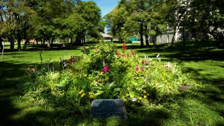
Bowring Park
Location of Bowring Park Google Map of Bowring Park
The Park is located within 4.8 km (3 miles) of downtown St. John's.
Bowring Park's Origins and Attractions
In 1911, Bowring Brothers, a successful trade and shipping firm, commemorated their 100 business anniversary in Newfoundland by giving the City of St. John's a 20 hectare (50 acres) recreational park as a token of their appreciation to the local community. The park was officially opened on July 15, 1914. History of Bowring Park Today, Bowring Park is over 81 hectares (200 acres).
Amenities:
Ball Field
Bungalow
Cabot 500 Theatre
Canteen Facilities
Conservatory
Diverse Tree Cover
Dog Park
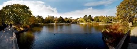
Man-made Duck Pond which is home to swans and ducks
Monuments
Fountain Pond with large population of Koi
Fully Accessible Playground and Splash Pad
Outdoor Swimmimg Pool
Poolhouse
Skate Park
Soccer Pitch
Tennis Courts
Walking Trails along the Waterford and South Brook Rivers that are part of the Grand Concourse, an award-winning integrated walking network. City Map of Bowring Park
Bowring Park Bungalow
To book an event at the Bowring Park Bungalow, please contact the current operator, Red Oak Catering Inc.:
Phone: (709) 368-6808
E-mail: info@redoakcatering.ca
Website: Red Oak Catering
Bowring Park Foundation
The Foundation, a not-for-profit organization, is governed by a volunteer Board of Directors which is elected by its membership. It was established on April 18, 1995, to assist the City of St. John's in the restoration and development of Bowring Park. The City and the Foundation partnered on the 2005 Bowring Park Master Plan which sets out a program of recommendations for the upgrading of the park.
Phone: (709) 364-1531
E-mail: bpf@bowringpark.com
Website: Bowring Park Foundation
Facebook: The Bowring Park Foundation
Vehicle Access
Vehicle access to Bowring Park is controlled by an electronic arm at the East Entrance which requires a code. Vehicular traffic is limited to service vehicles and patrons using the Bowring Park Bungalow only. However, the City does attempt to provide limited access to those with special needs. Contact the City of St. John's Access Line Access 311 and your request will be forwarded to the Parks & Open Spaces Division of Public Works.
Parking Advisors Blue Zones are located:
- on the East Entrance parking lot next to the Duck Pond
- on the Staff parking lot next to the Bowring Park Conservatory
- next to the Bowring Park Lodge which is located at 305 Waterford Bridge Road
Also please note that service and delivery vehicles for Special Events need to have pre-arrangements made through the City's Special Events Permit.
For additional help, contact information or to submit a service request, please visit Access 311.
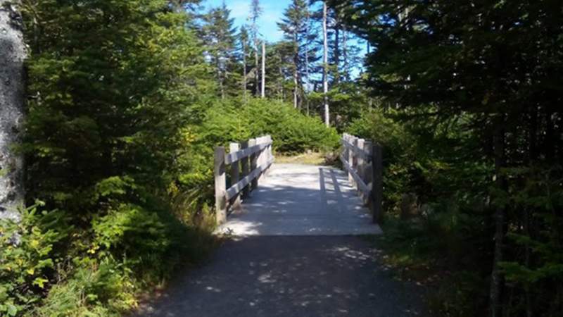
Rotary (Sunshine) Park
Location: Portugal Cove. See Google Map
Amenities:
Beach
Chalet available for rent for over-night activities
Dense tree cover, very natural environment
Docks and non-motorized water activities
Extensive Walking Trail network
Open Spaces
Secluded, rural park
Winter Activity Centre
Victoria Park
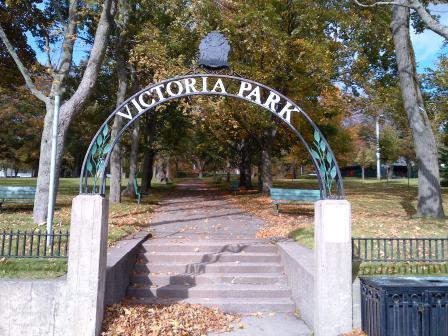
Location:
Located in the west end of St. John's, the park occupies the same 6.5 acres of land now as it did when it opened in 1890. The Park is bounded by Water Street on the south, Sudbury Street to the west, Hamilton Avenue to the north, and Alexander Street to the East. Bennett's Creek, covered over in two stages during the 1940s and 1960s, runs through the centre of the steeply sloping upper half of the Park and down the southwest side.
The flatter lower side of the Park has formally laid out paths and plantings, as well as recreational infrastructure installed in later years.
The Park itself is surrounded by a mix of residential, commercial, industrial and institutional uses, characteristic of this older neighbourhood.
Amenities:
Ballfield
Community Centre
Dog Park
Monuments
Open Spaces
Playground
Sliding Hill
Walking Trails
Revitalizing Victoria Park:
In 2015 the City worked with a project consultant and steering committee to carry out a public engagement process designed to help shape a revitalization plan. The What we Heard document reflects the common themes heard throughout the public engagement process.
In June 2015, Council approved a concept plan for the revitalization. Check out a 3D rendering and the final plan.
In 2016, the Victoria Park Foundation was formed to raise funds which will be matched by the City dollar for dollar to implement the Victoria Park Master Plan. Current information about the foundation and the plans for revitalization can be found on the foundation website www.victoriaparknl.ca.